Hyperspectral Segmentation
This gallery demonstrates the lithological segmentation workflow using EnMap hyperspectral data and Bayesian inference.
Gallery Overview
These examples cover the complete pipeline from raw hyperspectral cubes to georeferenced lithological maps with associated uncertainty. The workflow integrates remote sensing feature extraction with probabilistic classification.
Key Concepts
Feature Extraction: Dimensionality reduction (MNF) and extraction of geologically relevant spectral features (e.g., absorption depths).
Bayesian Segmentation: Using spatial priors and spectral likelihoods to classify surface units.
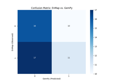
Geological Integration: Comparing surface segmentation results with 3D geological model predictions.
Uncertainty Quantification: Estimating classification confidence and entropy across the scene.
Prerequisites
Basic understanding of hyperspectral remote sensing.
Familiarity with Bayesian classification concepts.
Installed packages:
rasterio,scikit-image,scipy, in addition to the core Mineye dependencies.
Workflow Stages
Preprocessing & Feature Extraction: Preparing the hyperspectral data for classification.
Segmentation: Running the Bayesian engine to produce lithological labels.
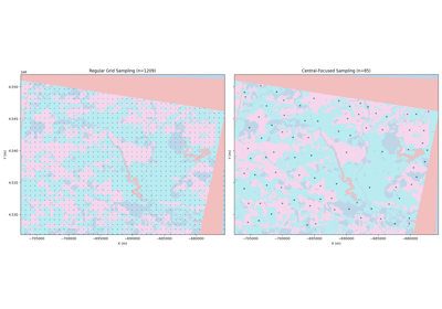
Validation: Evaluating results against known geological structures and extracting points for further modeling.
Note
The examples in this gallery require EnMap L2A products. Paths to data should be configured in mineye.config.paths or provided as environment variables as shown in the scripts.